Construction of a road through the Manawatū Gorge was first begun in 1871. The road traverses the rugged terrain between the Ruahine and Tararua Forest Parks, to link the east and west coasts, providing a route between Hawke’s Bay and Palmerston North.
Geography of the gorge
The Manawatū Gorge is an unusual geographical feature. The Manawatū River rises on the eastern flank of the Ruahine Range near the east coast of the North Island and has cut its way right through the range of hills which runs from north to south, forming the steep-sided gorge. The river then continues to flow westward, meandering through the fertile Manawatū plains until it reaches the Tasman Sea on the west coast of the North Island.
First routes through the gorge
Māori were adept at travelling through the gorge in canoes, though this could sometimes be perilous; early European settlers were able to rely on Māori local knowledge and navigation skills. But by the 1860s there was increasing pressure for a land route and so in 1867 a bridle track was formed along the south bank of the river. This was just the first step, however, and within a few years the demand was for a proper road which could take horse-drawn vehicles.
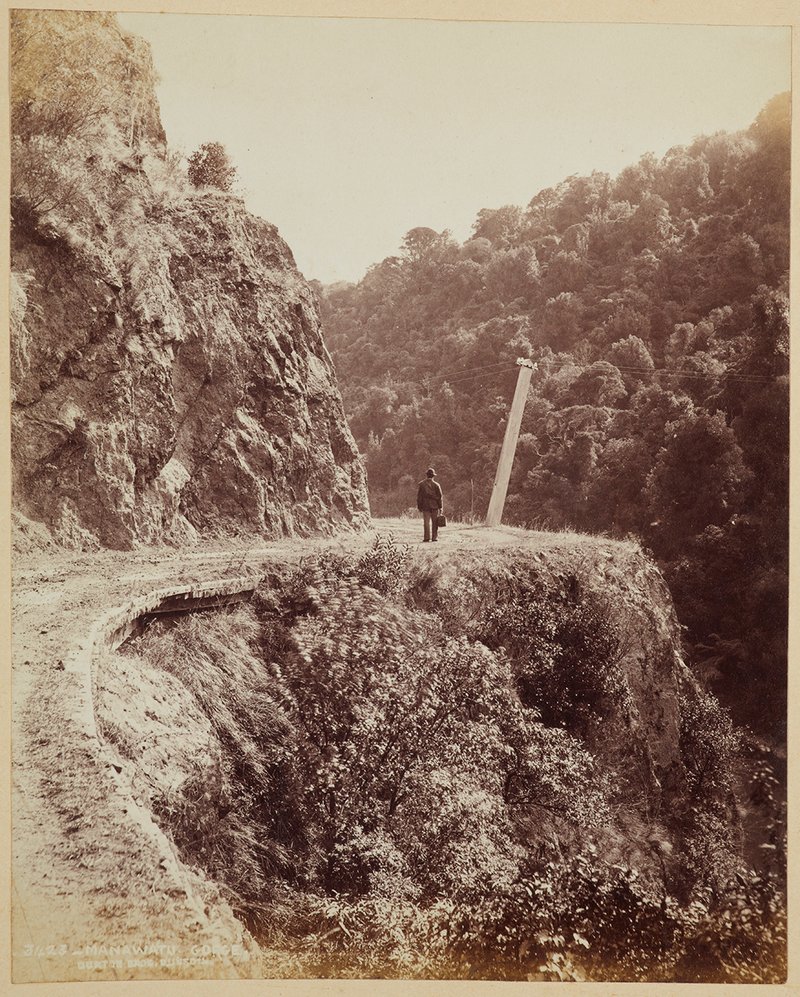
Manawatu Gorge, circa 1890, Manawatū, by Burton Brothers. Te Papa (O.006847/01), https://collections.tepapa.govt.nz/object/348198
Work begins on the road
In 1871 work started on the road, the contractors being Clark Dunn and Henry McNeil. The road followed a route on the south side of the gorge later known as State Highway 3. At first there was no bridge at either end of the road; so at the east (Woodville) end travellers had to ford the Manawatū River or be ferried over in a punt or canoe. A road/rail bridge for that site was designed by Mr J Carruthers, Engineer in Chief in New Zealand, built by the contractors (McNeil and Dunn, again), and opened on 31 May 1875. Horse-drawn coaches could now pass between Palmerston North and Hawke’s Bay – though they still had to be ferried over the river at the Ashhurst end until a bridge was built there eleven years later. The bridge was washed away by a flood and was replaced in 1909: that bridge in turn was replaced by a much wider concrete structure in 1969.
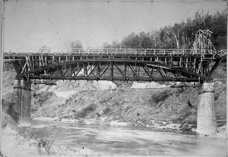
Upper Manawatu Gorge Bridge in 1891 – E Hall, Woodville, Palmerston North City Library, https://manawatuheritage.pncc.govt.nz/item/c9ef1ddf-f8f8-4642-9697-21057eac03a3
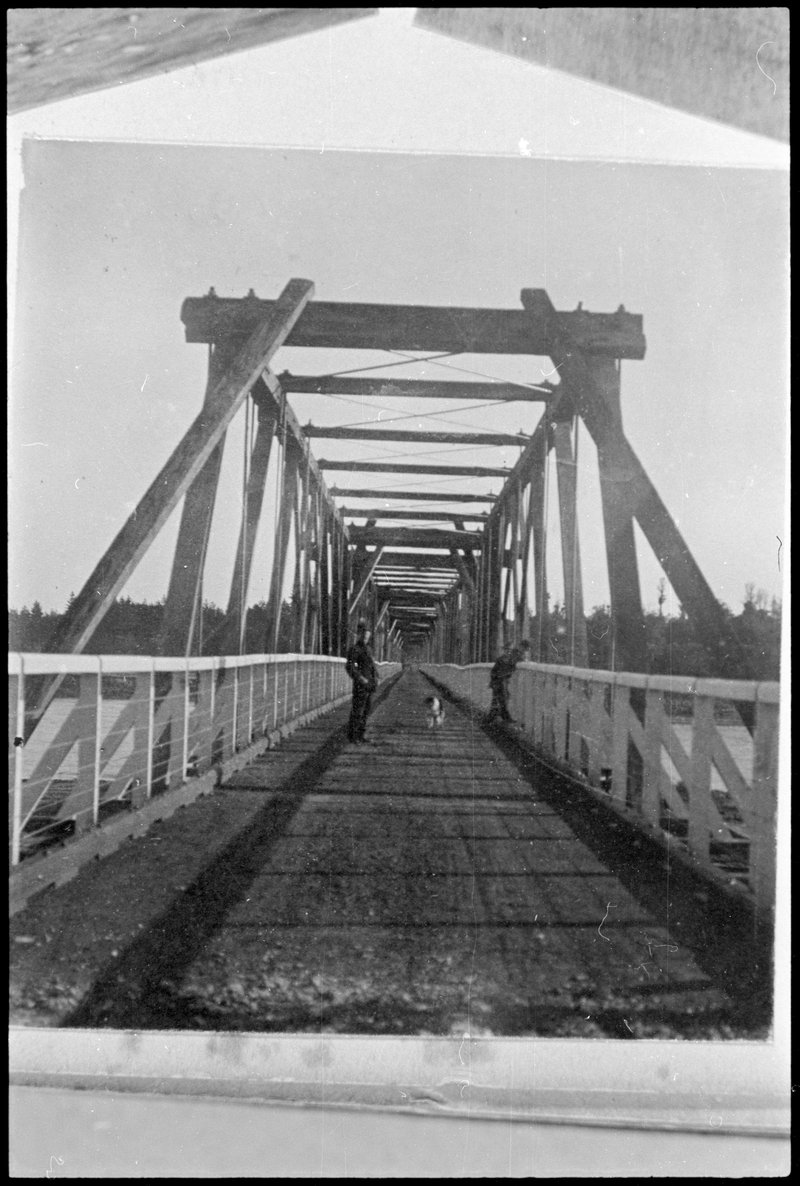
The second bridge at the Ashhurst end in 1909 – Palmerston North City Library, https://manawatuheritage.pncc.govt.nz/item/8bbca654-983b-47bb-91a4-8ee600b755ce
A difficult road to maintain
From the very beginning the road was subject to frequent slips, the rock on the south side of the gorge being very unstable. The fact that the road was narrow was also a problem and some of the bends were difficult for horse-drawn vehicles to negotiate. Over the years many improvements were made, including major widening to take large modern vehicles, and replacement of bridges. However, the susceptibility to slips did not improve and, in fact, worsened. In August 2011 there was a huge slip – the largest ever to have occurred on a New Zealand road at that time – which meant that the road needed to be closed for fourteen months while repairs were carried out. And in April 2017 another slip occurred which has caused the road to be closed permanently. A completely new road on a different route is scheduled to open in 2025.
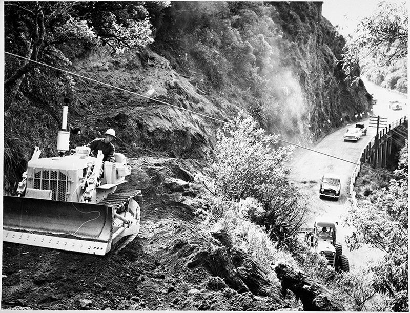
Bulldozer working on widening and realigning the Manawatu Gorge Road, Evening Standard 1 November 1969. Stuff Limited.
More information
Michele Frey and Contributors, Te Āpiti Manawatū Gorge Te Au-rere-a-te-tonga: a history (Palmerston North: Te Āpiti Governance Group, 2019).
Entry by Roy Sharp
Page last updated 09 April 2024